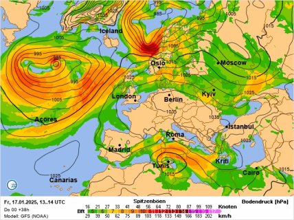
Ukraine will experience a "thermal anomaly": what to anticipate from the weather on January 17.
Nature has prepared an unusual scenario for Ukrainians on January 17. Cold air will be moving in from the south, even though this part of the country is typically the warmest.
Nighttime frosts will create a cold corridor stretching from Transcarpathia through Podolia, Chernivtsi region, and all the way to the Sea of Azov. This was reported by the well-known meteorologist Natalia Didenko on her Telegram channel.
In the southern regions, temperatures will drop to -4 degrees at night. Other areas of Ukraine will experience only slight frosts around zero. However, the situation will change drastically during the day – temperatures in the south will rise to +5 degrees, while other regions will not exceed +3.

The Left Bank will see wet snow mixed with rain. Right Bank Ukraine will remain dry. The main danger on January 17 is the strong northwestern wind, so it’s advisable to be cautious outdoors.
Warm weather will persist in Ukraine for a few more days. True cold is expected after January 23.
Weather in Kyiv
On January 17, clouds will blanket the capital. No precipitation is anticipated. Air temperatures will fluctuate between 0 and +2 degrees. The northwestern wind will strengthen.
Recall that earlier "Telegraf" reported that snowy weather is returning to Ukraine. Several regions will be affected by precipitation.